


2022 WORLD RALLY FLYING CHAMPIONSHIPS DAY ONE
By Tarryn Myburgh
Google Banner Ad
THE BUILD UP
Not sure what rally flying is all about? Not sure what the lingo means? Go to www.airheart.co.za
With the event in South Africa, the local teams have many advantages. The host country is also allowed to enter 10 teams, rather than the normal 5, meaning there is opportunity for some of the newer teams to qualify too. In addition to the larger field, we have an enormous home ground advantage with the ability to train in our own aircraft in the area that we will be flying in. Lastly, it costs significantly less to fly in our back yard than to travel to Europe and rent a larger and more expensive aircraft there.
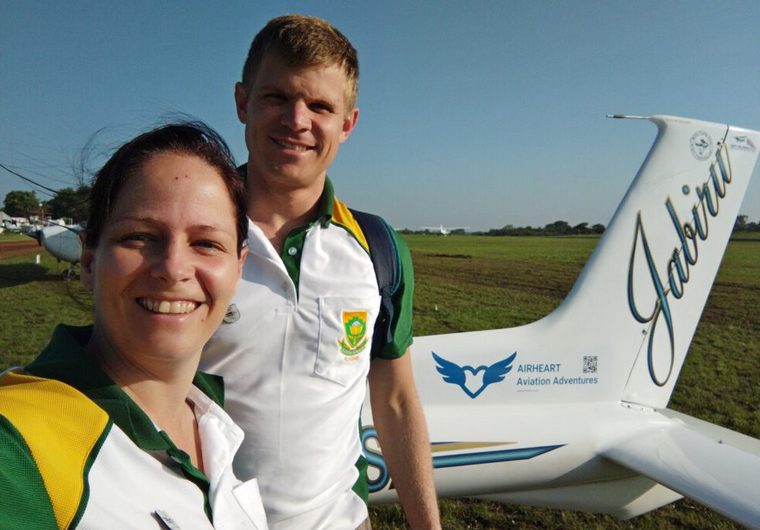
Iaan and I qualified for the South African team in Brits in June 2022. Flying 'Bonsai' our tiny Jabiru, with my husband Iaan as my navigator, this is the story of our experience in the 22nd FAI World Rally Flying Championships.
After what feels like an hour but is really only 10 minutes, we finally manage to enter the airfield. Final preparation begins. We have 30 minutes before briefing so we will have to move smooth and fast. We prepared as well as possible yesterday but it is time for a final once over. We make sure to clean the windows (again). I hope that these sparkling windows will somehow improve our photo spotting. Next is the pre-flight where I check that every part of the aircraft is serviceable and in working order. We place the various and numerous tools where they need to be. Scissors, pens, highlighters, minute markers, special measuring tools, photo boards are all placed very specifically. Nothing is left to chance. 30 seconds to find a pen is too much when the pressure is on!
Finally, it is time to warm up the engine before moving to our allocated parking spot, Parking Bay 9. This will be our parking every day of the competition. With very little time left before the competitor briefing, we shovel in a few mouthfuls of breakfast at the clubhouse before making our way to the briefing hangar.
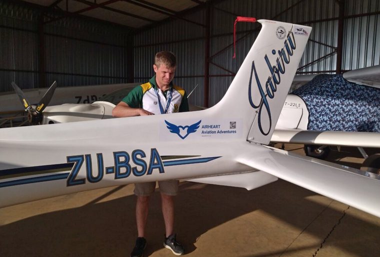
Final Aircraft Inspection and Preparation
THE CONDITIONS
At least we are able to fly after a week of pouring rain and low cloud that caused chaos at the official practice week. Unfortunately, the wind is coming from an unusual direction and the less favourable runway 20 is in use for take-off and landing. The butterflies start to feel more like horses in my stomach. The prevailing wind here is from the north and it means that I haven't practiced landing in this direction.
We know that the wind, now 7 knots, gusting to 21 knots (39km/hr), will result in a tough day for us, particularly when flying against a headwind. Conditions improved throughout the day and the later flyers had much calmer conditions, lower wind and the wind changing direction to the preferred runway of 02. Unlucky for us!
A lovely looking morning before the wind starts to pick up
THE PLOT
The timing in a rally is based on elapsed time from take-off. This means that our take off time is 09:32a.m. but at this moment, our stopwatches read 0:00 as we start to accelerate down the runway. Don't start too early as the penalty is a heavy 200 points. I found this out the hard way during a previous competition when I crossed it 2 seconds early. The Start Point is 9 minutes from take-off, giving us plenty of time to find it and try to gauge the wind from the air.
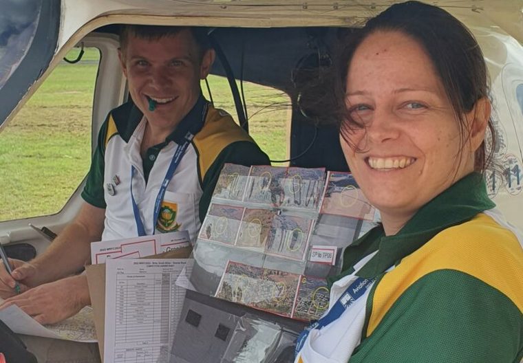
We even have time for a photo by Rob Jonkers while we are plotting
FIRST HALF
Today's start point is a farmhouse that we haven't used before but is relatively easy to find. It helps that the start photo is true. Setting up was a challenge due to a stronger than expected tailwind. We cross it 16 seconds early. Slightly disappointed but now better prepared for the tailwind on Leg 1, I use full flaps and slow down to 55kts, a full 20kts slower than our chosen airspeed of 75kts. Even this slow, I have to snake down the first leg to manage the tailwind. We still need to lose the time we gained at the start point as well as account for that pesky tailwind. Fortunately, we are flying past the distinctly shaped Kareepoortberg hill. This means that we have a good idea of where we need to go to find turn point 1, and we can snake around without fear of getting lost. I wouldn't dare try this if I didn't know exactly where I was going. You can lose your sense of direction so quickly! We spot our first enroute photo and arrive at TP1 within 2 seconds of the target time for a bingo score. The turn point photo is clearly true, and we turn right onto our next leg.
The second leg takes us to the base of a small dam where two rivers converge, hidden just behind a small koppie. With our tailwind still blowing we slowly snake our way there. We are familiar with this dam but the unusually heavy rain over the past two weeks, has caused the incoming rivers to overflow dramatically. Turn point photo 3 looks nothing like the feature on the ground. We mark the photo as false and get another bingo for time. I'm thrilled as I normally struggle with such a strong wind.
We are now exiting the agricultural areas surrounding Brits. The third and fourth legs take us past numerous townships that support the mining in the area. We manage to spot a few enroute photos, but also know we are missing many. The wind is now a crosswind making the timing slightly more manageable. We are 6 seconds early for TP3 and 4 seconds late for TP4, still very respectable.
Leg 5 is very short and straight into the wind. We know we are in trouble right away. We are late at the first feature that can be used to check timing even though we are already going full pace. Luckily, the navigation is easy as we fly towards the easily identifiable Hartebeestfontein town. If the small hill topped by a cell phone tower don't give it away, the name on the hill does. Fortunately, we only lose 15 seconds because of the short leg, but the distraction means that we also miss some more enroute photos.
Leg 6 is a sharp left turn towards more agricultural areas resulting in a crosswind again. Now away from built up areas, there are very few features on the map to use for navigation. The vast game farms have limited roads and buildings. After some detective work, we identify where the next turn point should be. We use a road that extends from the distant Vaalkop Dam to identify the nearly invisible canal crossing. We manage to cross it within 1 second for our third bingo of the day.
Now approximately half-way through the route, it is time to swap to our second photo board with the second half of the enroute photos. We know that the observation portion for this half is going to be challenging. Almost all of the photos are small paths in the bush. These are difficult to identify at the best of times but the recent rain has changed the scenery from the dry, brown bushveld in the photos to dense, green shrubbery. Pools of water cover every normally open area and normally dry streams are flooded making the photos almost impossible to spot.
In addition to the demanding navigation, Leg 7 and Leg 8 start to turn back into the wind. Historically, we have struggled to navigate in this area where the only features are numerous farm boundaries. Confusingly, these farm boundaries tend to be bigger than the main roads in the area, however they aren't marked on the map. We have spent hours flying around these farms to try and familiarise ourselves with them. Our hard work over the past few months seems to pay off as we easily identify where we should go and manage to get within 2 seconds at TP7 for our fourth bingo. This is followed by 5 seconds late at TP8, a bridge to the north of a large township.
Leg 9 takes us to a trig beacon on top of a small and lonesome hill that hides the tiny township of Ga-Tsogwe. We can see the turn point clearly from a distance but we struggle to identify the turn point photo as true or false. It is on top of a rock outcrop with no nearby infrastructure and I can't see any distinct shapes, trees or other features to help. I can't see the trig beacon in the photo but it is clearly visible as we fly over. We can't decide and leave it out. It does not affect our timing as we are only 3 seconds late. Leg 10 takes us towards the Vaalkop Dam wall. Our debate over the turn point photo means that we lost time even with the tail wind and we are again 3 seconds late. We are also starting to get frustrated with the difficult enroute photos.
Leg 10 is an arc that takes us over the Vaalkop Dam and into another difficult to navigate terrain. The Vaalkop Dam is shaped like an open crocodile mouth. We start to fly between the two 'jaws' and soon lose sight of the only road nearby as it meanders away into the dense shrubbery that appeared after the rain. Some more detective work is required and we work out where the turn point is by drawing imaginary lines from the towns and hills in the distance and maintaining our speed and direction. This is difficult on an arc but we hold steady and hope for the best. We manage to navigate to where we estimate the turn point must be, but we aren't sure which farmhouse it is. We lose 33 seconds in the process. This is what happens when you get distracted! We are late and not sure about the turn point photo either.
Having lost so much time already, we are in big trouble for the final leg as we turn straight into the headwind. Fortunately, the finish point is a road-power line crossing that we often use as a start point during our training and I know exactly where it is, without even looking. With nothing more to do, going full throttle, the result is that we are 29 seconds late to the finish point. Flying at 95 knots, we made up only 4 seconds over the leg. Fortunately, there is no finish point photo as I forgot to look as we zoomed over it as fast as possible.
There are 16 minutes after the finish point to hand in your answer sheet. Iaan starts to measure the location of the enroute photos and fill in the answer sheet while I am approaching for the landing. Now that we have landed, only 6 minutes remain. I quickly double check Iaan's measurements before we hand over the answer sheet to the waiting marshal and we are escorted to the debriefing room.
At debriefing, the judges download our track and mark our answer sheet. We found only 8 enroute photos, missed all of the ground markers and made a mistake with turn point photo 3. Apparently under all that water, the photo is correct. We also left two turn point photos blank where we were uncertain. Each of these mistakes cost us penalty points and of our total score of 978 penalty points, 630 are for observation.
Later we find out that the trig beacon that I couldn't see at turn point 9 must be in the turn point photo (according to the rules) and it is therefore removed from the results. Phew! That really helps us.
The landing score of 60 is exactly what I hoped for. Of our total 288 penalty points for navigation over the route, 174 points were scored in the last two legs. It is not a fantastic score but considering the wind, we are satisfied. Our score places us 25th overall, and 8th of the South African Teams. The margins are small, and we are only 100 points behind Marco and Leon in 22nd place. On to tomorrow….
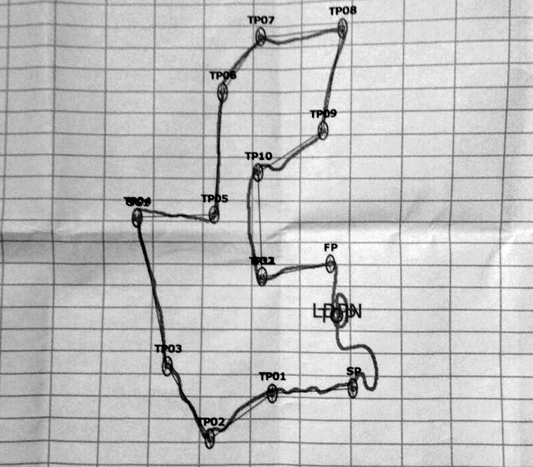
Our track over the route
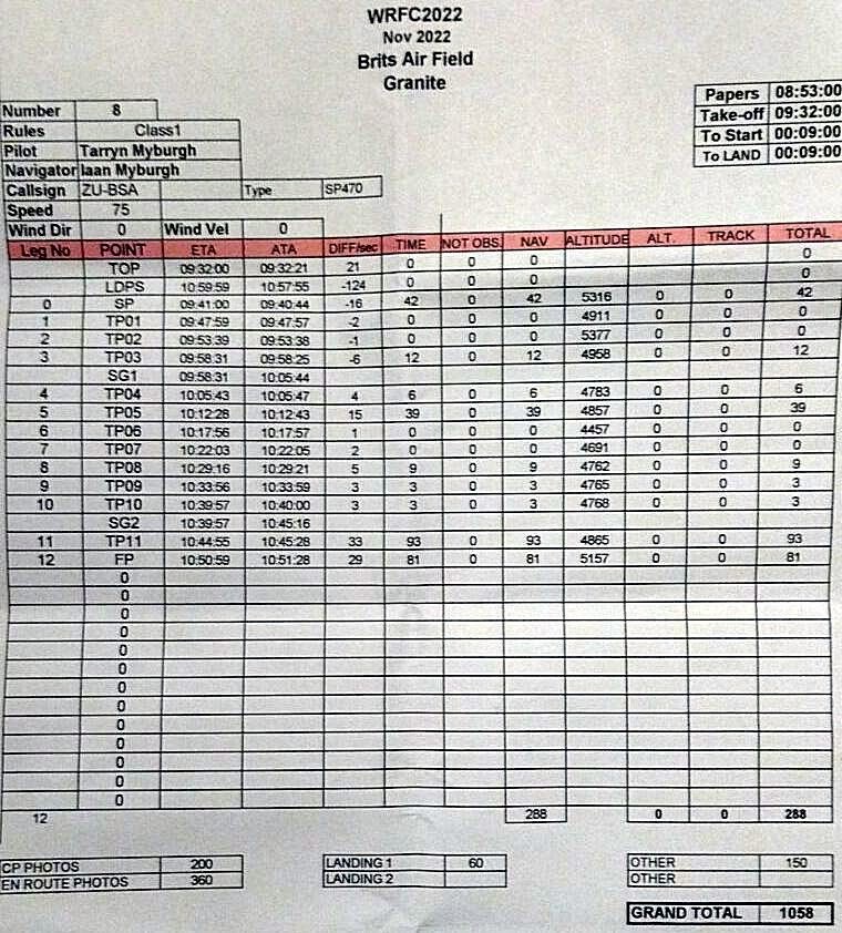
A breakdown of our scores for the day
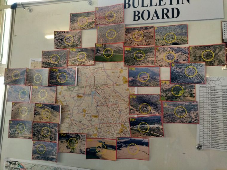
The master map showing the route and the location of the photos
Go to
www.airheart.co.za
for more off Tarryn and Iaan's flying adventures
Google Banner Ad

 |
 |
 Copyright © 2024 Pilot's Post PTY Ltd
The information, views and opinions by the authors contributing to Pilot’s Post are not necessarily those of the editor or other writers at Pilot’s Post.
Copyright © 2024 Pilot's Post PTY Ltd
The information, views and opinions by the authors contributing to Pilot’s Post are not necessarily those of the editor or other writers at Pilot’s Post.