


MY 2022 PRESIDENT'S TROPHY AIR RACE STORY
By Tarryn Myburgh
Google Banner Ad
The PTAR is a two-day race with the aim of going as fast as you possibly can around a given course. Held annually in May or early June, it is one of the most prestigious events on the South African aviation calendar. First held in 1937, coinciding with the opening of Durban's new airport Stamford Hill, it was called the Governor's Cup.
The race format was initially 1000 miles over all four provinces of South Africa at the time. The first ever winners flew a Hornet Moth at an average speed of 120.3 mph from Durban via Ladysmith to Rand Airport in Johannesburg for an overnight stop before returning to Durban via Bloemfontein, Kimberley and Bethlehem where they were presented the winner's cup by the Governor General of South Africa.
The race changed name to the State President's Trophy in 1962 and finally to the President's Trophy Air Race in 1994. The format has also changed several times. Most recently, the rules changed to include both a speed and an accuracy component, similar to the new Speed Rally series.
Google Block Ad
Unfortunately, we are not able to participate in Bonsai, our tiny Jabiru. We don't meet the minimum speed requirement of 100kts, even going as fast as we can! We also don't have the endurance to complete these longer routes while going flat out because it dramatically increases fuel consumption.
Even though we can't participate, Iaan and I can't bear to miss out on the largest aviation race on the calendar. Last year we helped with marshalling at Ermelo and had such a great time that we volunteered to help again this year. A lot of planning goes into an event of this size. Besides the extensive legal requirements, there is venue management, finding volunteers, arranging marshals, fuel bowsers, printers, turn-point markers, GPS loggers, scoring systems and trophies. The list goes on and on. I was making sure the procedures were in place while Iaan would be helping with the scoring on the weekend.
Google Banner Ad
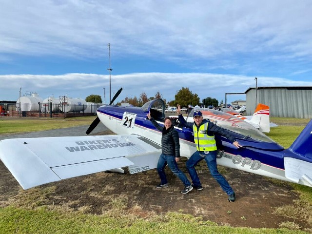
As luck would have it, two weeks before the race, a friend asked if I would be interested in navigating for someone. He had been promoting the PTAR to the pilots at his airfield and there were a few pilots that were interested but didn't have a navigator. I couldn't believe my luck. We popped over the taxiway and set about convincing Mike, the pilot in question, that he absolutely couldn't miss this race. Pilots prefer to fly themselves if they can, and friends or family are often anxious about navigating, particularly in a competition. Often, these opportunities fizzle out because pilots don't like to lose, and who would trust a stranger to navigate them around a course? But we convinced Mike to clear his calendar and he arranged to meet us at New Tempe the day before the race in his RV8.
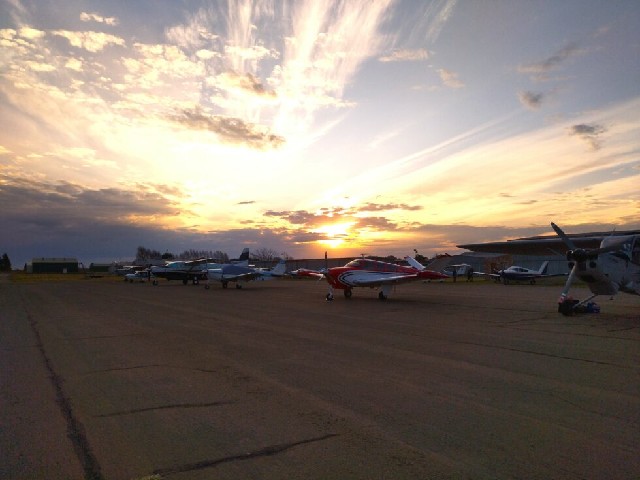
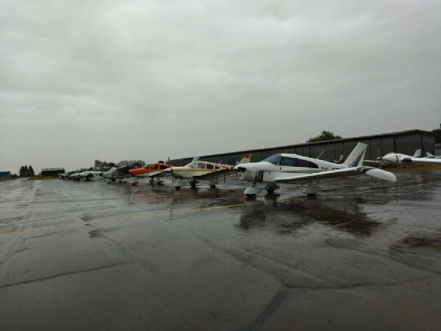
Some of the Thursday arrivals
The speed test is used to calculate your 3D speed. Your 3D speed is the speed that you will try to fly at during the race and the closer to this speed over the race route, the better! This speed is adjusted for each particular route to get your handicap speed, which is based on the number of sharp turns and the speed of your aircraft. The assumption is that the faster you are, the more distance you need to go around a corner.
I wait around on the apron until Mike comes back from the speed test with the news "Our 3D speed is 185kts!" I know that an RV is quick but neither of us expected this. Considering that I normally fly at 95kts in a Speed Rally, this might make life interesting for me. We will be flying at nearly double the maximum speed that the Jabiru is capable of. Some of my enthusiasm is replaced by nerves. I have never been in anything near this fast and I am hoping I can keep up as the navigator.
Google Banner Ad
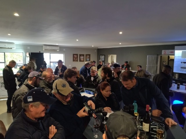
Amongst competitors, the President's Trophy is often called the "coldest weekend of the year" and this year will be no different. Inland South Africa is known for its cold and dry winters, usually perfect for flying. As evening approaches, temperatures are already dropping. We all gather in the enormous hangar for the official briefing. Meteorologists from Weather South Africa join to give us the bad news; a cloudy and wet day is expected for Day 1 of the race. A cold front is inbound, and the accompanying cut-off low pressure system means that strong wind and unseasonable rain will persist all day. We all remain optimistic. Weather forecasts are often wrong, aren't they? Rain in winter?!
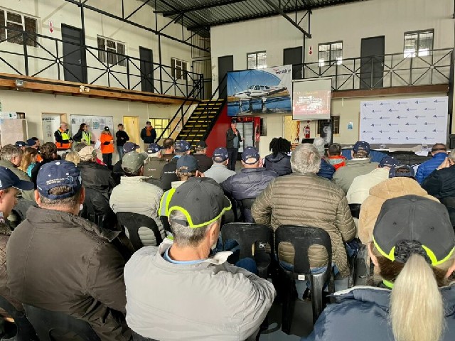
Teams optimistically listen to the pre-race briefing
Day 1 of the race dawns, cold and dreary. It soon becomes apparent that this is indeed going to be a very miserable day. Everyone is bundled up in layers of jerseys, windbreakers and scarves as we scuttle off to our planes to dry them off, start them up and prepare for the day. Raincoats were a scarce commodity as the rain caught most of us unprepared. After about an hour of waiting, alternating between the rain on the freezing cold apron and the fireplace inside, the news arrives. The turn-point marshals have reached their destinations and report low cloud. Day 1 is cancelled. Disappointed pilots gather around the fire, coincidentally located inside the pub, to commiserate.
A cold and dreary day at the airfield
Each question is read out loud and we have a few moments to debate amongst ourselves before writing down our answers. The spirit of competition is heating up with humorous banter between the teams keeping us entertained. Once we have marked our answers, we pass the answer sheet to the next team to be marked. We start to get excited when we realise that we have all the answers correct, but alas, we aren't the only ones. A final round of three questions will determine the ultimate winners. With the last question about aviation law, we somehow pip our competition! Our team, the Drunken Skunks, spends our winnings drinking rounds of Jägermeister to keep us all warm until late afternoon.
The Drunken Skunks debating their answers while ensuring the glasses are full
As Day 2 arrives, the weather already looks better. Although it is still cold and overcast, the cloud is lifting, and the rain has already stopped. The turn-point marshals have to negotiate some impassable roads resulting from the previous day's rain. Some have to walk far through the mud, but they finally make it to their positions. This makes it quite challenging to put up the orange car covers that we will use to spot the turn-points from the air, but they get creative and make it work.
Day 1 typically starts with the fastest aircraft first. In this format, each aircraft sets off 30 seconds apart and follows a large 'circular' route, finishing back at the airfield. While we missed Day 1, the Day 2 format is really exciting. Day 2 starts with the slowest aircraft first and consists of a 'cross-over' or bow tie type route that crosses over the airfield near the mid-point of the course. The fun of the Day 2 format is that the take-off times are calculated so that if everyone flies at their handicap speed, all the participants should cross the finish line at the airfield at the same time. It also means that the slowest aircraft start to cross over the airfield while the fastest aircraft are still taking off, adding to the spectator value. From our experience at Ermelo last year, it is incredible to see around 60 aircraft crossing the airfield at the same time!
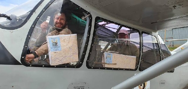
The 2021 Joint Winners excited to race in their Bosbok
Finally, it's our turn. We collect our envelope containing our maps, turn-point photos and GPS loggers. The maps are enormous; it's a good thing we aren't in Bonsai! I spread the A2 map over the nearest dry surface I can find, a car bonnet. The maps are pre-plotted with the route and the magnetic heading for each leg. The pre-plotted heading on the map can be adjusted by up to 5° in any direction. This adds a navigation challenge for those who rely on digital instruments, which can correct for the wind, and it promotes traditional navigation using the map.
I start adding minute markers and familiarising myself with the area we are flying through. While pilots are never lost, the minute markers are helpful as they give an idea of where you should be on the map if you become temporarily unsure of your position. The RV8 is a tandem aircraft, meaning that the passenger sits behind the pilot. This means we get two copies of the photos and the maps so we can each see a copy as we fly. With our maps marked, highlighted and folded origami style, it is time to start up. Mike does a pre-flight, we jump in and taxi to the holding point.
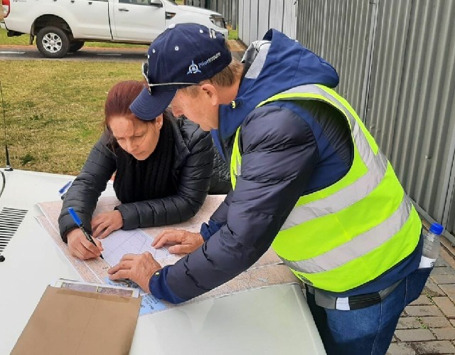
Adding minute markers and familiarising ourselves with the route
Leg 1 starts with a stretch of non-descript veld but a dam in the distance helps us confirm that we are on track. I am checking our time against the minute markers on the map and about 2 minutes from the turn-point, we start looking for the orange car cover that marks each turn-point. "There" Mike says. He has spotted the orange. I realise that while the visibility to both sides is fantastic, the forward visibility as a passenger is very limited in a tandem aircraft. I can't see directly ahead of us to confirm the turn-point but as long as Mike can see it, it is not a problem. I remind Mike again to make sure we go around the turn-point to avoid penalties for cutting the corner. We do another steep bank to the left and start looking for some identifying features in the distance. The map shows a few large pans but my heart sinks as I look up. I realise that there are hundreds of pans. In the dry Free State landscape, these are normally empty and all but invisible, but the recent rain has filled them all plus a few extra. There is water everywhere but none of it is on the map. The pans we are looking for are no longer as obvious as they look on the map so we rely on our heading until we can see the tiny agricultural town of Boshof that is just behind turn-point 2. This town lies deep in the rural countryside and is so far off the beaten track that most people will never stumble across it.
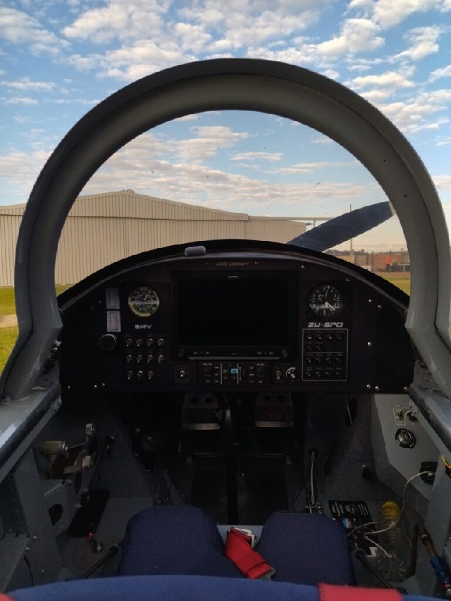
An idea of the navigator's view (minus the pilot)
Google Block Ad
Our next turn-point takes us directly back to the airfield for the crossover. This one is critical because if we fly too far past the airfield, we might accidentally cross into Bloemfontein International Airport's controlled airspace. While Bloemfontein is not the most buzzing destination and their Air Traffic Controllers are aware of the race, it would still be terribly embarrassing. We share a few moments of panic as we start to get closer and closer but still can't see the airfield hidden somewhere near the edge of the sprawling town. Why are airfields so difficult to spot from the air? "Yes! There is it! Phew…" With Bloemfontein's airspace looming, we turn right over the turn-point and head back away from the airfield.
Another easy leg goes by and I notice that the time is getting further and further away from our markers. I know we are on track, and we have found all the turn-points so far. Maybe the wind is slowing us down. There is not much we can do about it except to continue.
The next turn-point is at a small, solitary hill and directly behind it are a series of small, gravel roads. They lie somewhere in the typical flat, dry and non-descript veld that surrounds Bloemfontein for many miles. I think we turned a bit too far, but Mike is convinced we are on track. My mind is playing tricks on me, and I can't quite be sure. The further we go, the more certain I am that we are wandering off track but Mike is quite convinced. Suddenly I see it; the dam just before our next turn-point starts to peek out from behind some rocky outcrops in the distance. We are starting to wander quite far in the wrong direction but luckily, we recover relatively easily. The turn-point is obscured behind a hill but we manage to find it and make our turn.
Google Banner Ad
Every now and again on the radio, I hear Dieter in his Lancair hum the theme song from Jaws on the radio. He is closing in at a speed of 220 knots (250 miles per hour)! Suddenly I spot him. "On our left!" I say to Mike. "But where is he going?" Both Mike and I look back at the map. They are starting to get really crumpled up and the temptation to follow is quite strong, but we confirm our position and heading. "I think he may be a bit off track."
They pass us at a speed that makes us look like we are standing still and soon vanish from our view. Hopefully we will also start to catch some aircraft soon! I am excited; it isn't often that I overtake anyone in the air!
The final three legs towards the airfield are relatively easy and I can relax a bit more. I have a bit of fun waving at the marshals as we pass by the turn-points. What a feeling to be looking straight down the wing at the ground to see them waving from their braai (barbeque) as we zoom past. Disappointingly we still haven't passed anyone, and we only start to spot other aircraft as we zip over the finish line. I finally figure it out. Our handicap speed must be a bit optimistic, which explains why the minute markers slowly started to drift further and further and it is why we didn't catch up to anyone.
Google Banner Ad
Landing back at the airfield with so many aircraft in the air around us is another incredible experience. We need to have eyes in every direction as everyone tries to either slow down or speed up to the nominated circuit speed of 90kts and join into some sort of scraggly queue to land. While we do have Air Traffic Controllers at the event, it is very difficult to manage radio calls for this number of aircraft so they are kept to a minimum. The responsibility falls on us as competitors to space out, maintain speed and follow the aircraft ahead until landing. Once on the ground, we expedite off the active runway to allow others as much space as possible and park in the first available spot.
We all land in quick succession so there is a queue to hand in loggers. We get our phones unsealed as we slow down to hear some of the war stories being shared. Now that we are done flying, the hard work for the scorers and judges begins. While the other pilots and navigators go back to their accommodation to get ready for the banquet dinner and prize giving, Iaan starts to download GPS tracks and load the routes into the scoring software. GPS track glitches need to be fixed and penalties need to be reviewed. The more mistakes people make the longer scoring takes!
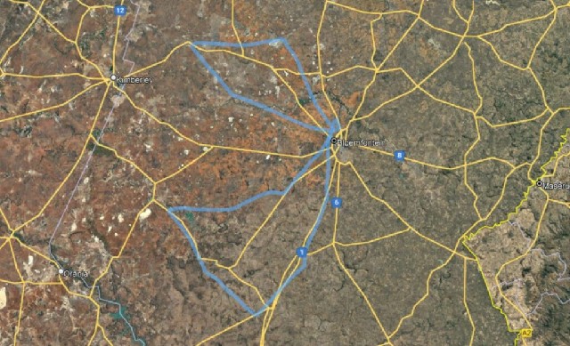
Our track
As Sunday morning dawns we prepare to return home, the weather is again looking miserable. The cloud base is high at the airfield, but the satellite imagery shows a band of rain halfway between Bloemfontein and Johannesburg. We load up and fuel up anyway as everyone departs. We are being fed updates on the weather conditions as our friends make their way back home and we get varying information from wildly optimistic to rather concerning. The doubt is enough in my mind and considering our much slower aircraft, I decide not to risk it. We can always stay the night and try again the next day! On Monday morning we get to the airfield early to calm and clear skies. After take-off, I start our turn out when suddenly I hear a voice over the radio "Aircraft squawking 2000 at 5000 feet, please contact Bloemfontein Tower on 120.80". "Oh my gosh, is that us?" I made them a bit nervous by approaching too close to their airspace. I apologise and promise to familiarise myself with their airspace in future. The rest of the 2.5-hour flight home is uneventful and we enjoy the calm weather, feeling so much better about the decision not to fly yesterday.
A perfect morning to fly home
Google Banner Ad

 |
 |
 Copyright © 2024 Pilot's Post PTY Ltd
The information, views and opinions by the authors contributing to Pilot’s Post are not necessarily those of the editor or other writers at Pilot’s Post.
Copyright © 2024 Pilot's Post PTY Ltd
The information, views and opinions by the authors contributing to Pilot’s Post are not necessarily those of the editor or other writers at Pilot’s Post.